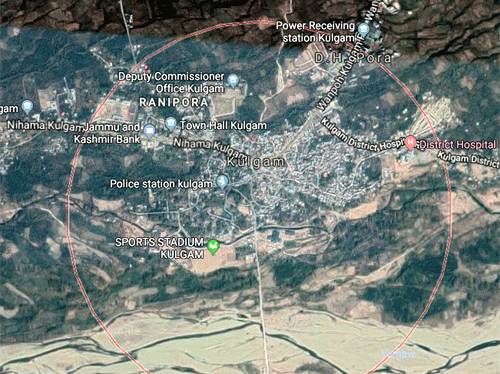
Location & Climate
Kulgam has geographical area of 1067 Sq. Kms, and is situated at a distance of about 68 kms from Srinagar and about 17 kms from Anantnag. Geographically, the district lies between 330 –15’ North Latitude and 740-35’ East longitude bounded in the East and North by Anantnag and Shopian districts respectively. It is also bounded by Reasi, Ramban & Rajouri Districts in the South and South west though separated by mighty and majestic mountainous range of Pirpanjal acting as a massive topographic physical protection.
 |
The District has road connectivity with its neighbouring districts like Shopian, Pulwama, Anantnag and Ramban etc, besides being linked with far flung areas of the district by a dependable road network. Nallah Veshav, which drains from northern face of Pir Panjal, is the main left bank tributary of river Jehlum and traverses through District Kulgam. Before confluence of Veshu with the Jehlum,The District has tourist spots like: “Aherbal Water Fall” on Veshu Nallah which is place of sight-seeing in extreme South-West of Kulgam. “Kung-Watan and Gurwatan” ahead of Aherbal; “Charebal” and “Nandimarg” highland pastures are also places of tourist attraction apart from virgin meadows in the area from ‘Kund’ to ‘Ladigasan’ (ahead of Aherbal Clefts). The District has super abundance of natural & fresh water resources also in the shape of various famous springs, such as, Kounsarnag (ahead of Aherbal), Waseknag (Kund), Khee Nag (Khee Jogipora) etc.

